Arch, Urban & Civil Engineering
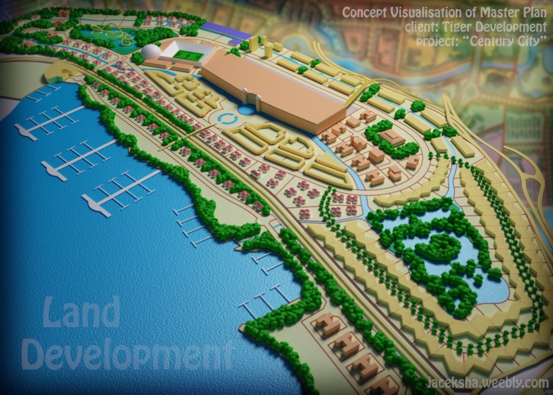
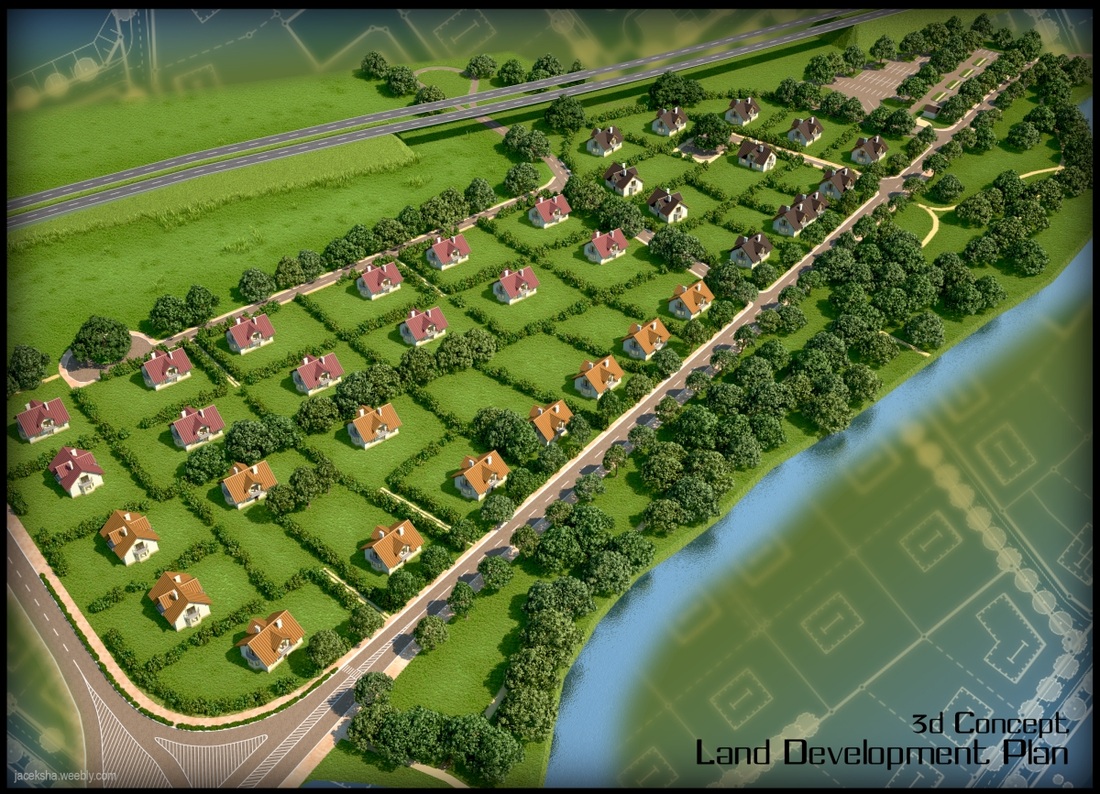
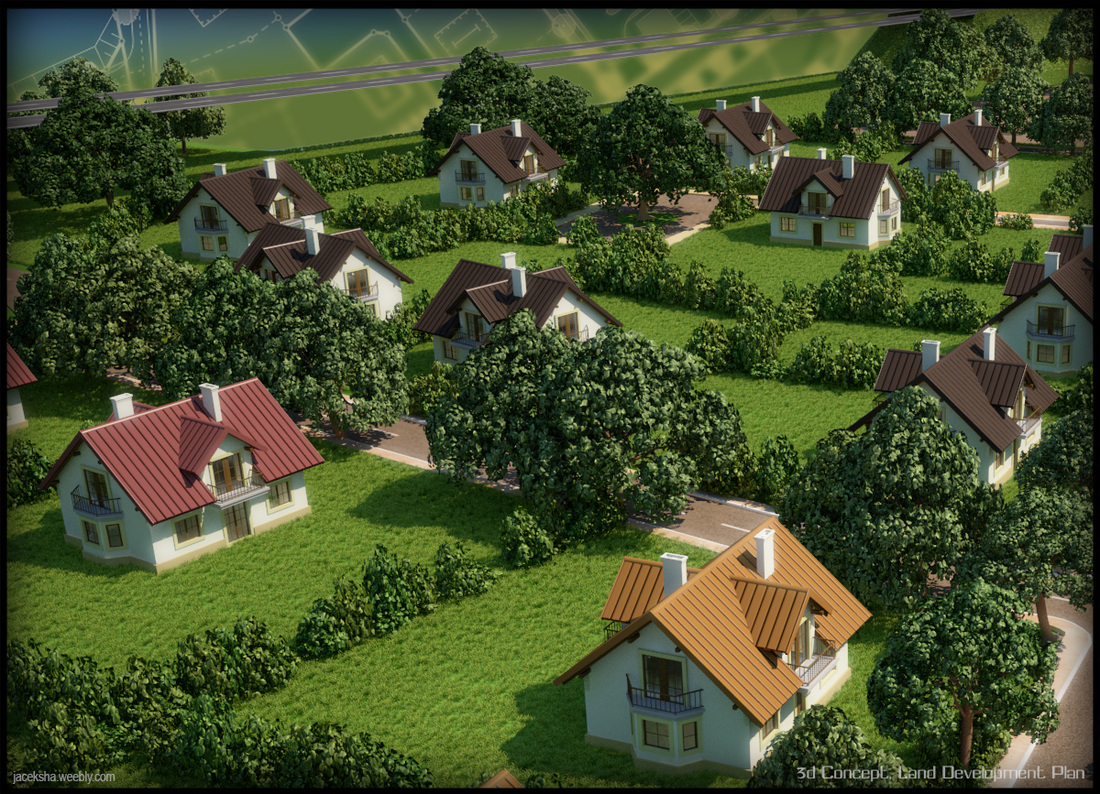
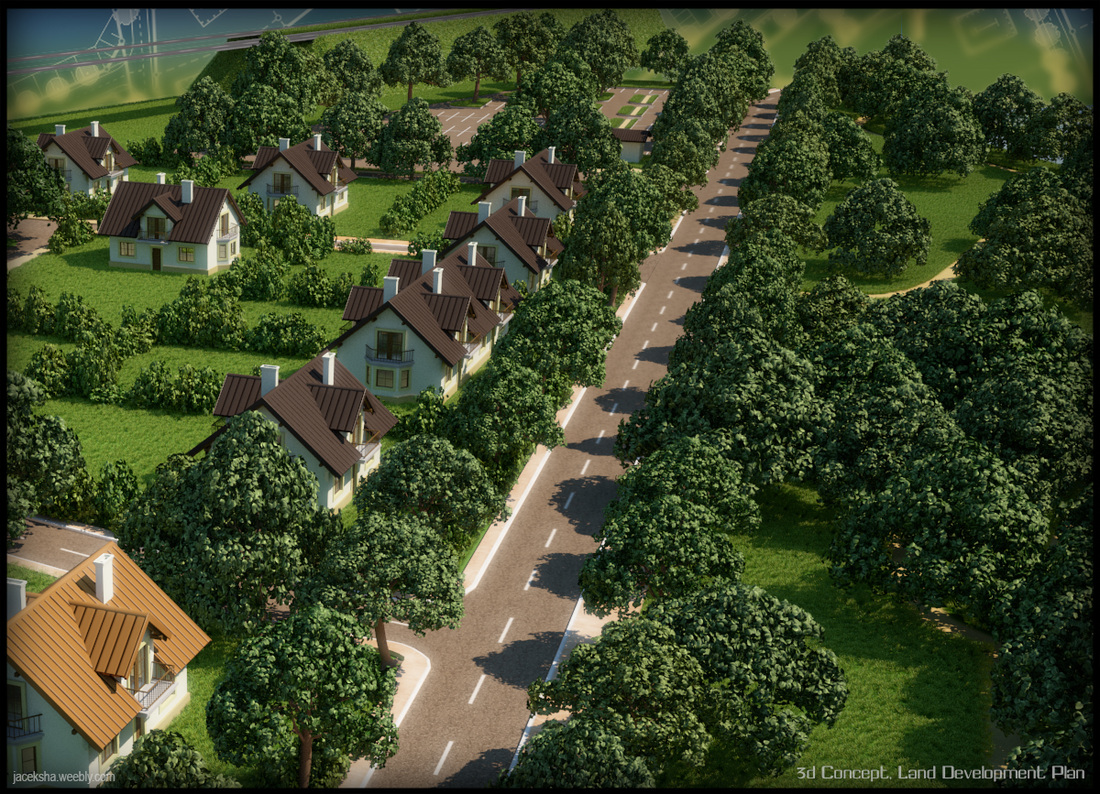
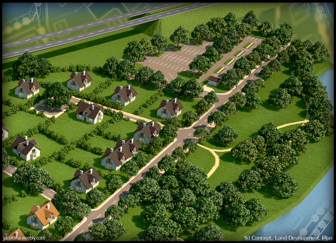
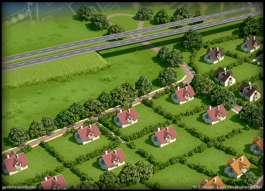
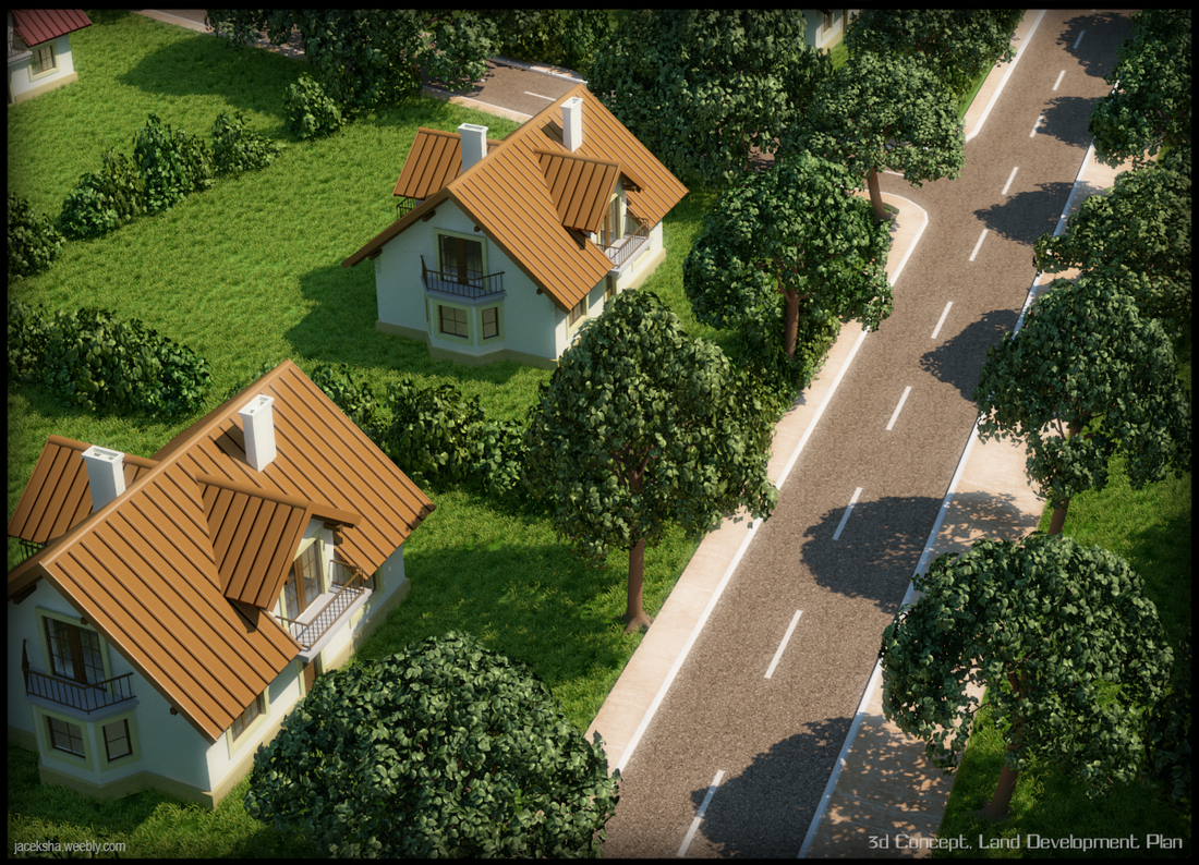
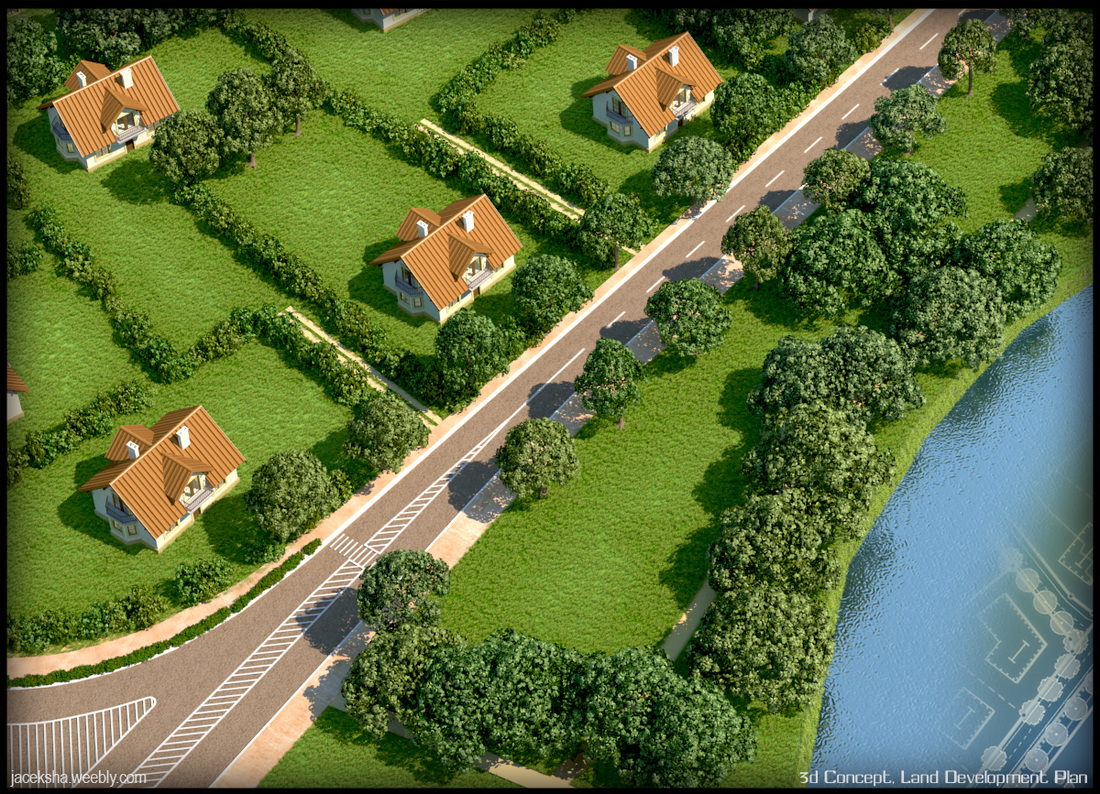
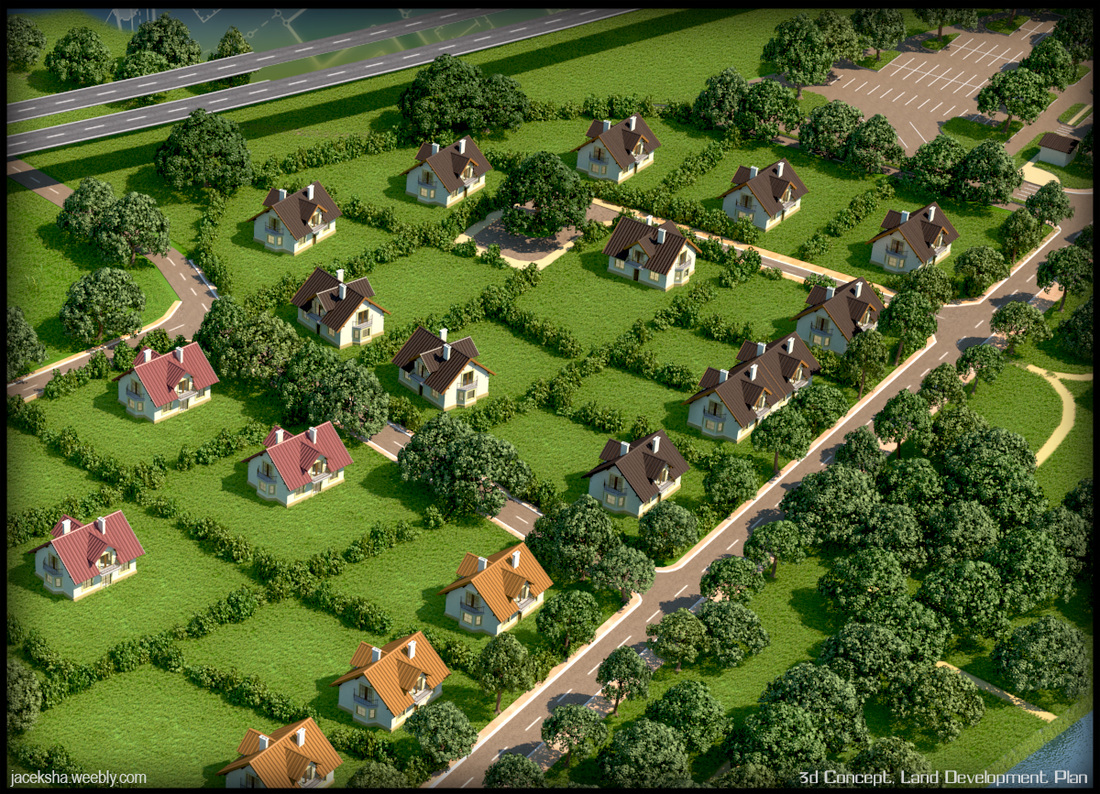
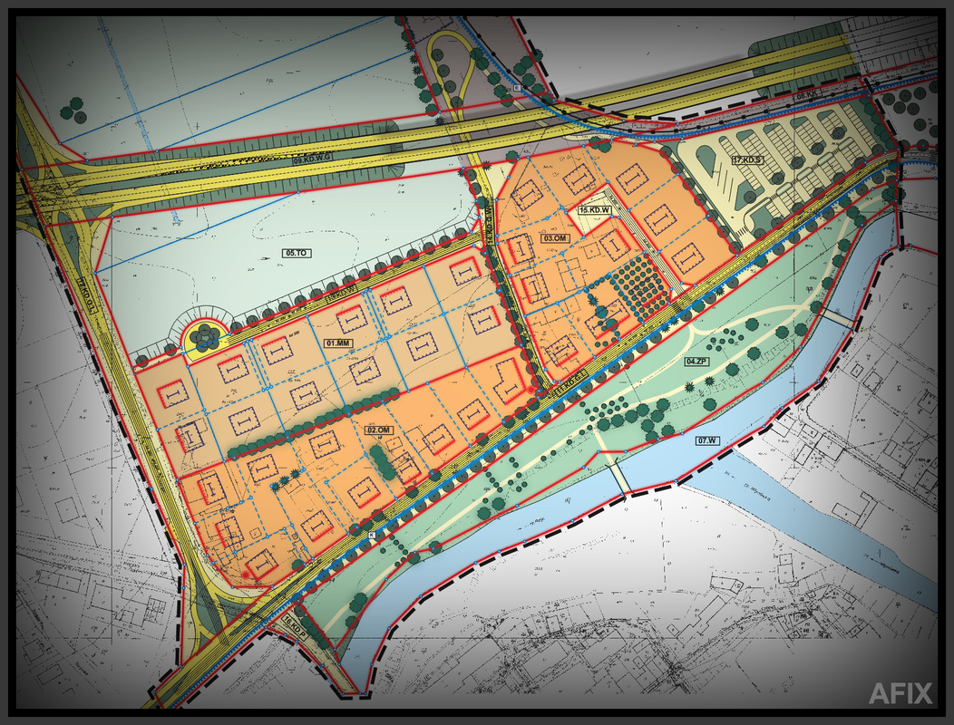
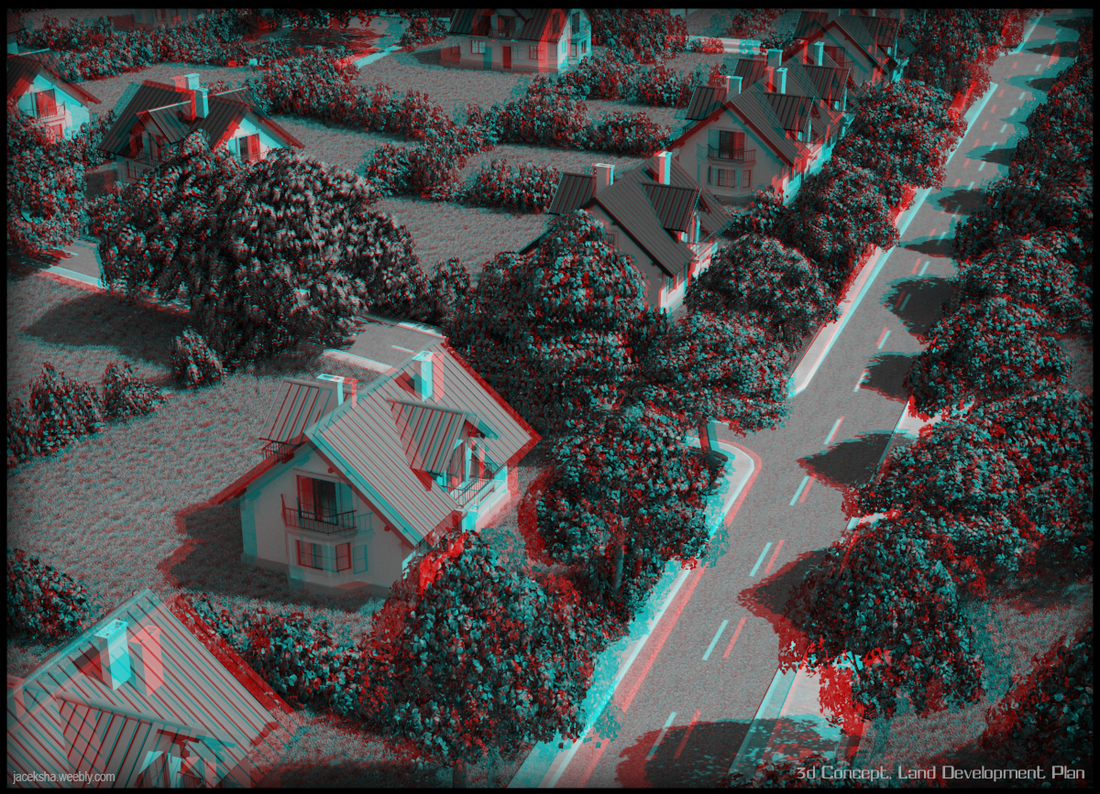
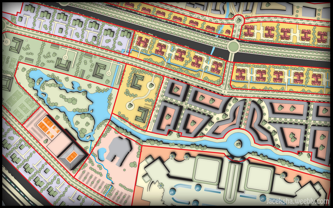
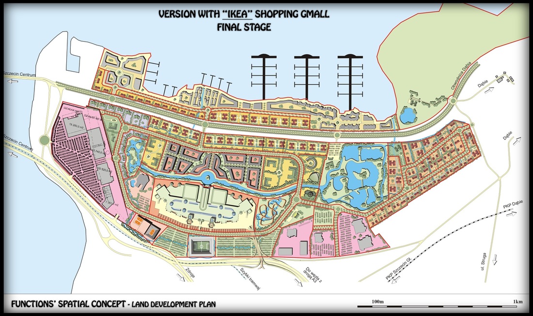
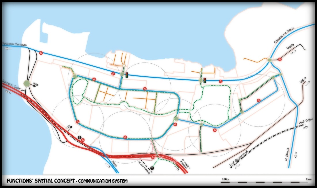
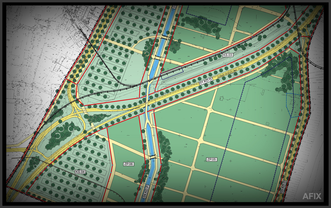
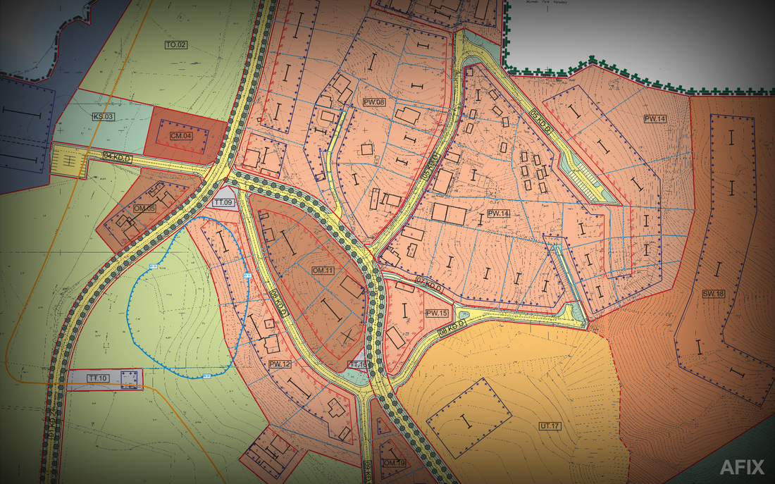
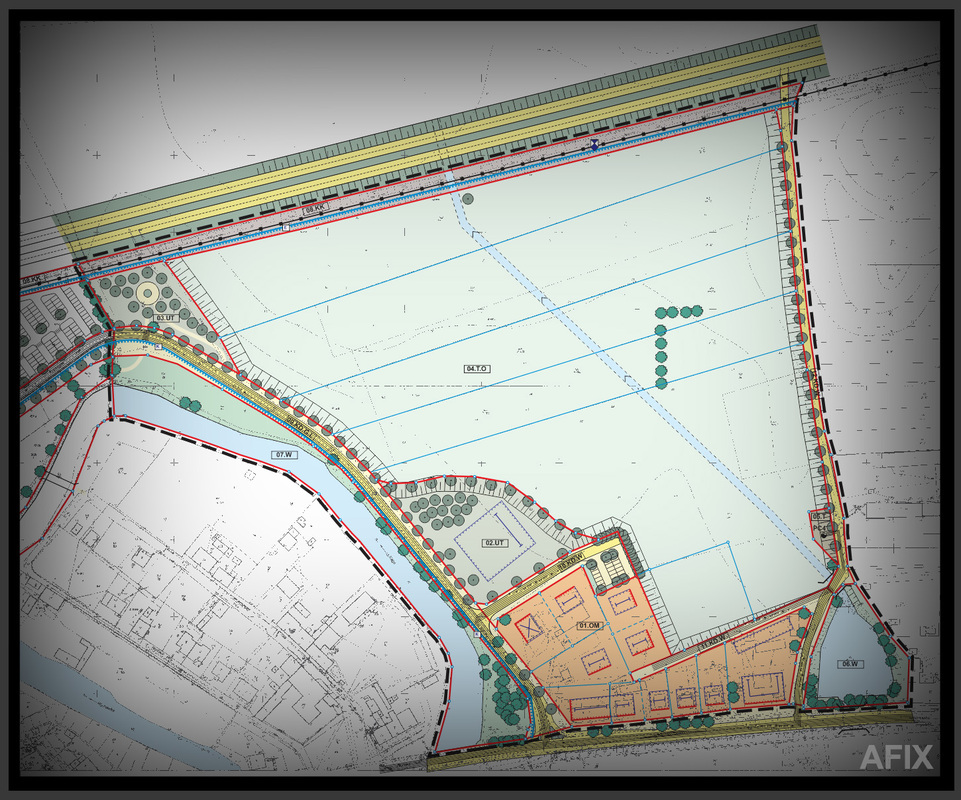
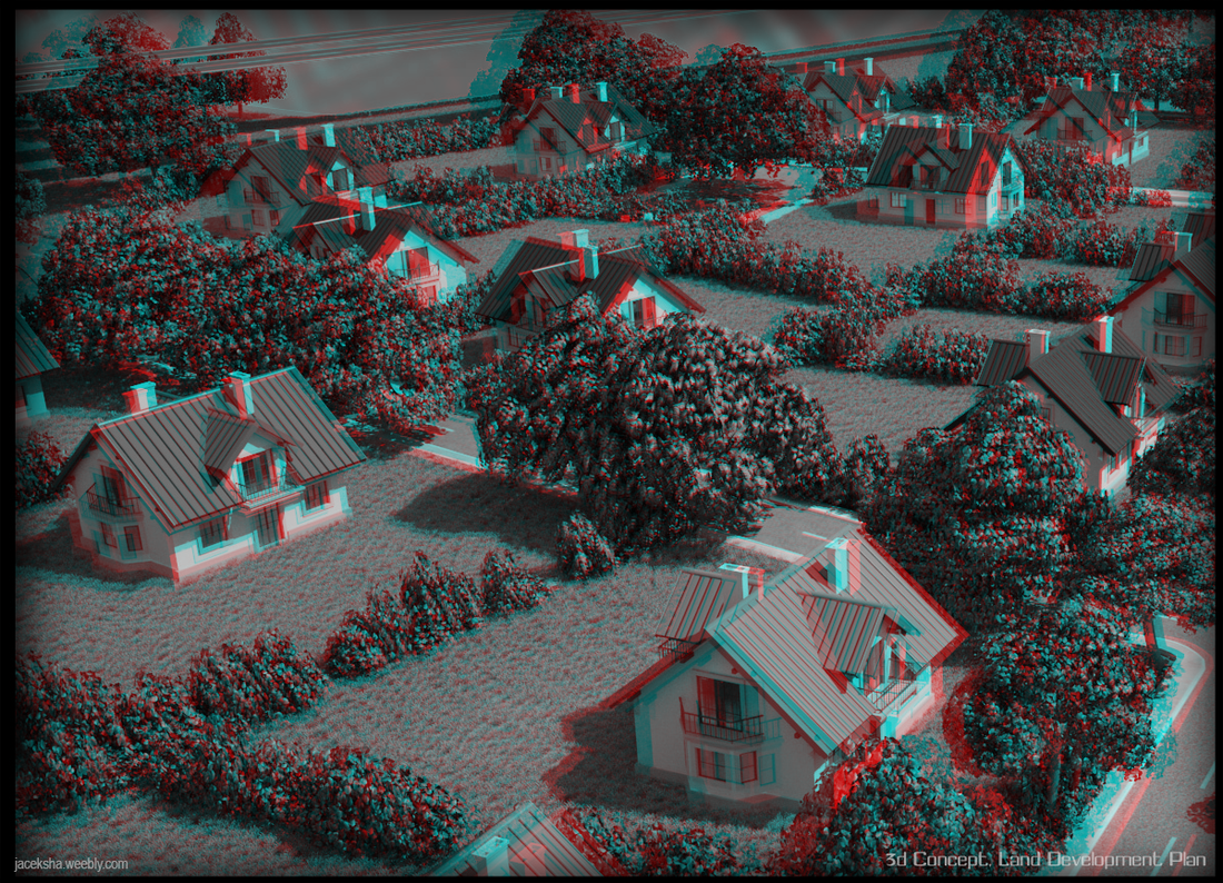
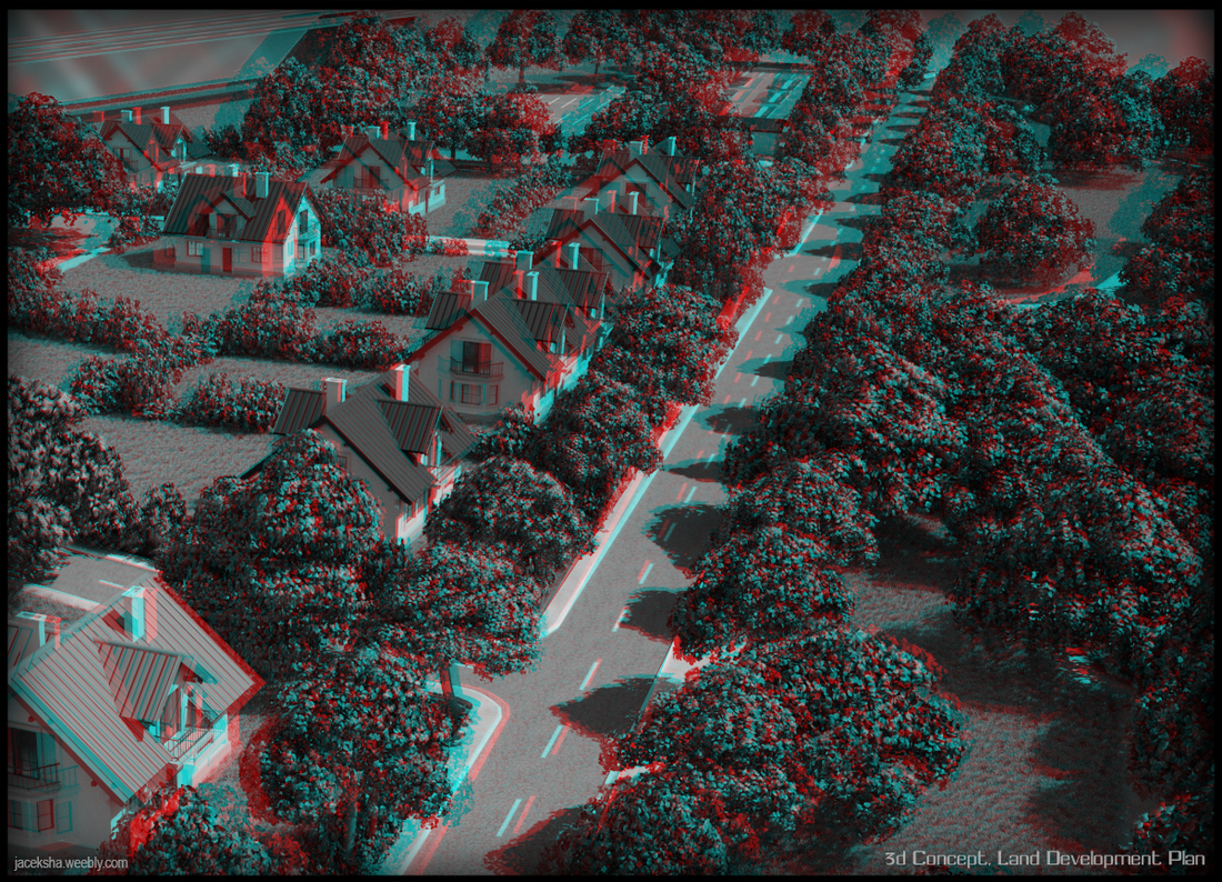
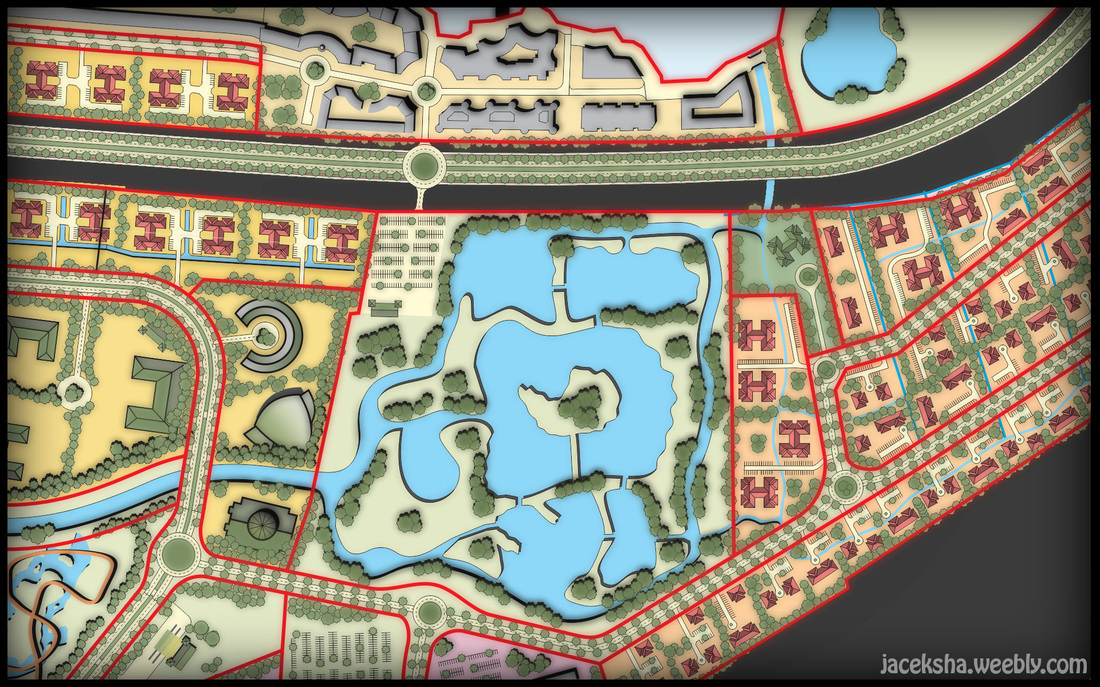
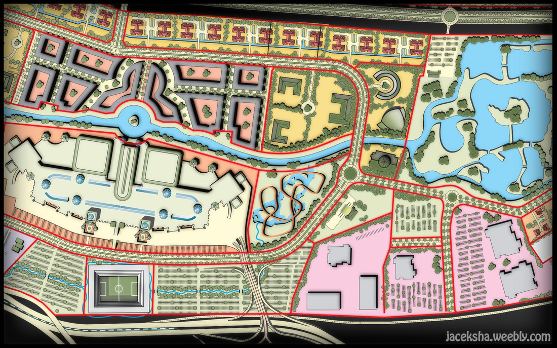
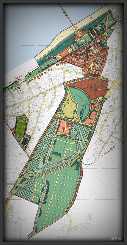
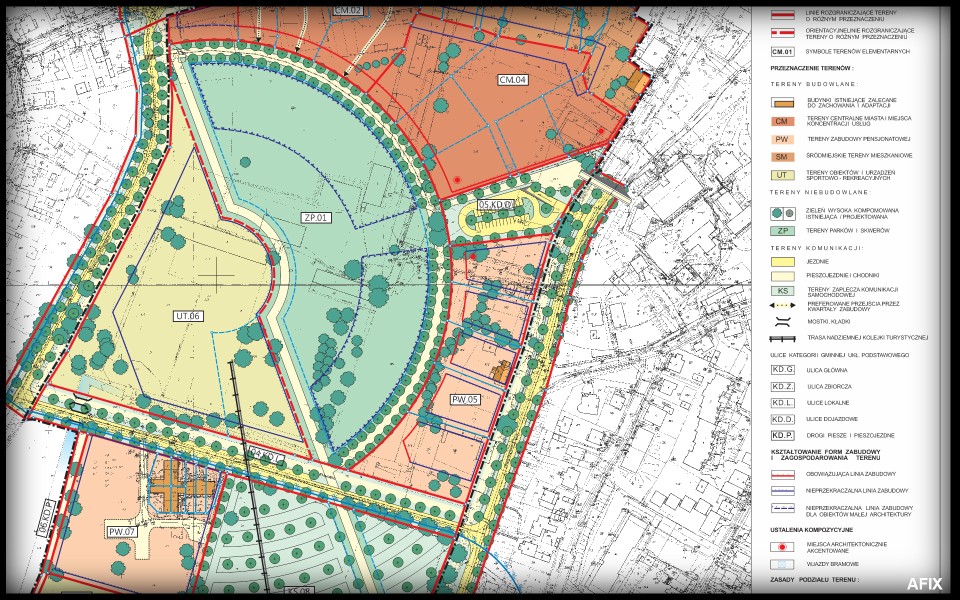
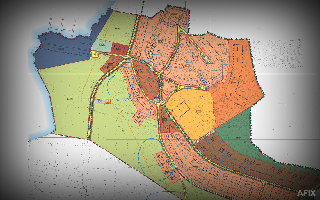
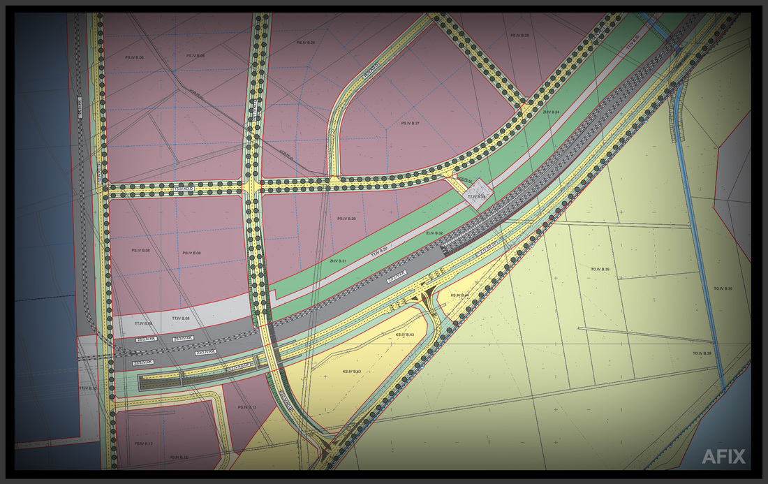
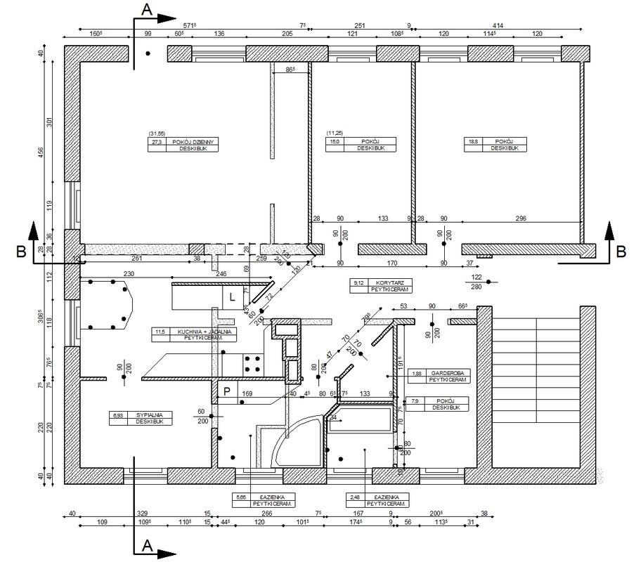
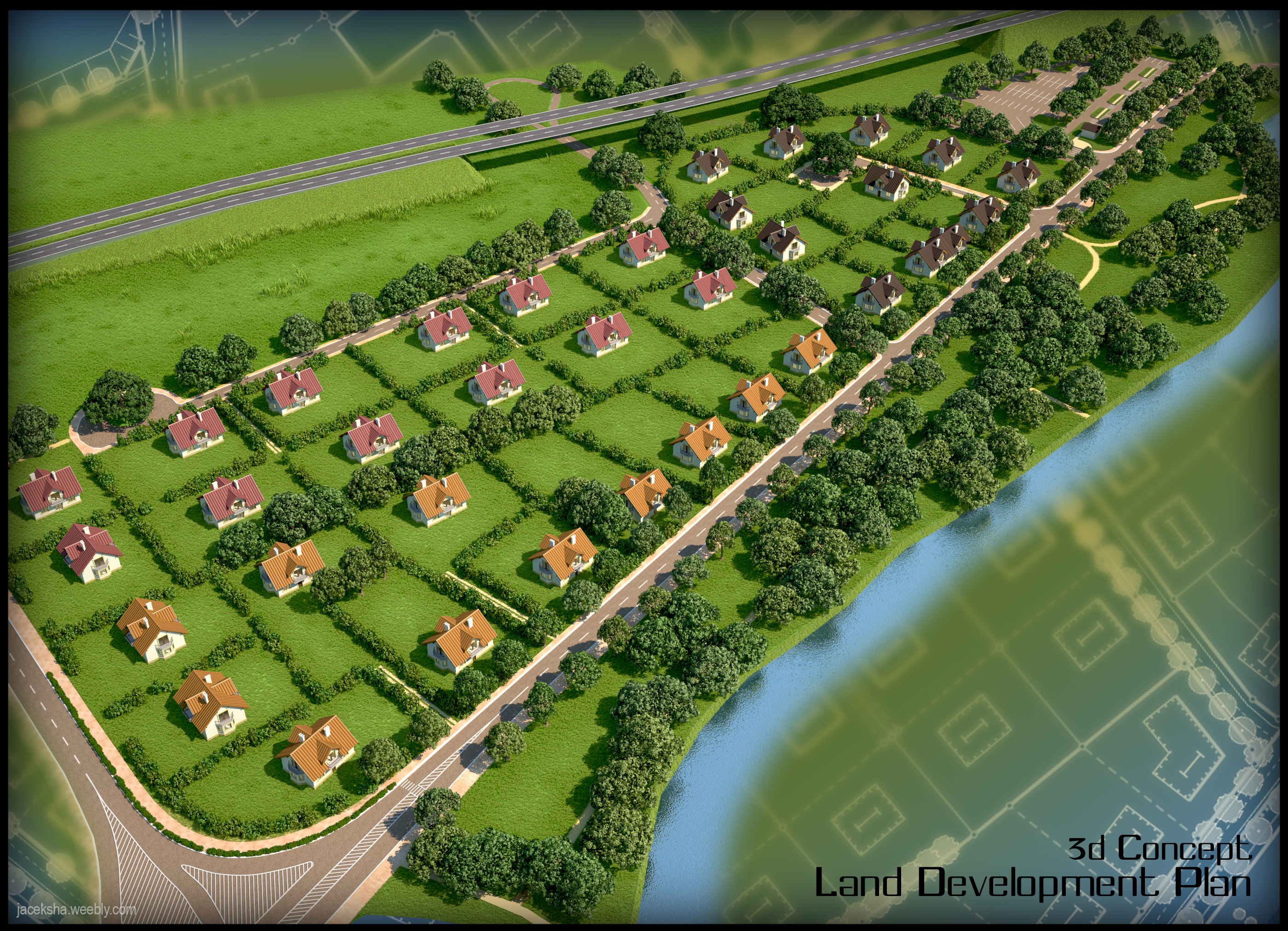
I've worked for 8 years in architectural / urban studio "AFIX" in Szczecin, developing cities' transport solutions assisting in Master Plans studies. MapInfo and CAD data were the base for drawing final ideas in CorelDraw with up to 1 m precission. On the base of urban experience I've developed for a client the Land Development Plan with different studies (functions, transport, ownership ect..). On the base of 2D plan I did also a 3d rough concept. The concept itself, was worked out with the client and given out to further urban studies.
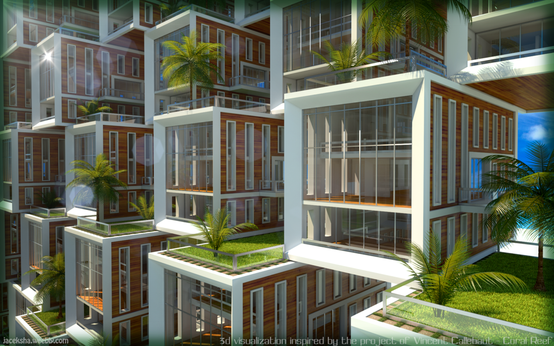
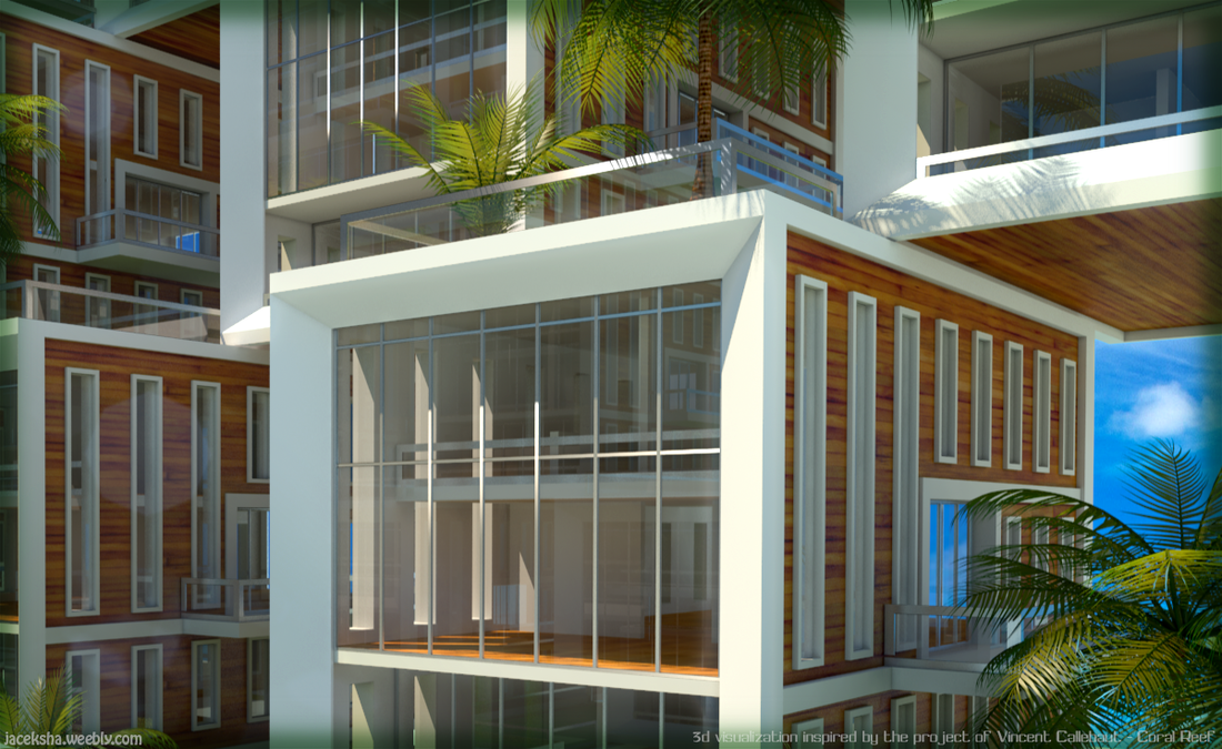
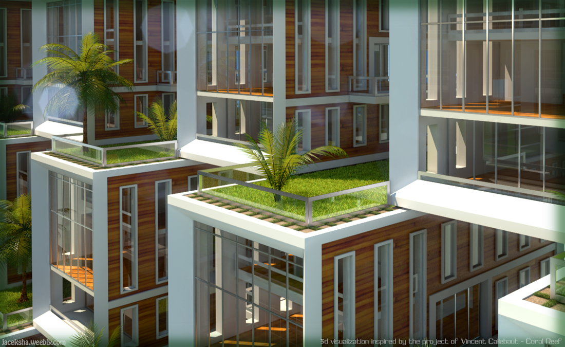
I've been inspired by futuristic visions of the famous architect - Vincent Callebaut. For the training I decided to recreate a small part of his project.
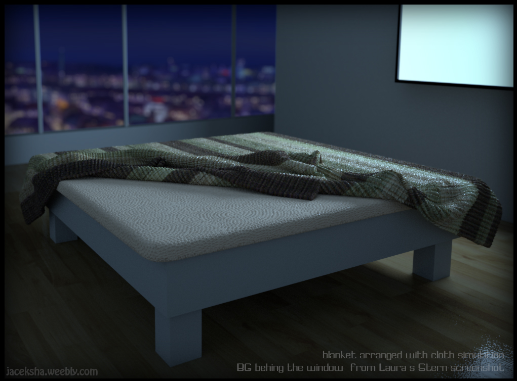
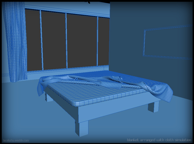
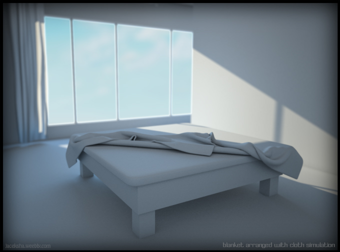
A small brakedown of adding effects.
|
|
With proper proportions of the 3e landscape elements, urban team can evaluate more accurately the drawn concept. Vector data from CAD and CorelDraw drafts are essential for creating such a 3d concept. Shapes of houses are introduced only for the size reference.
|
High resolution image 2800 x 2000
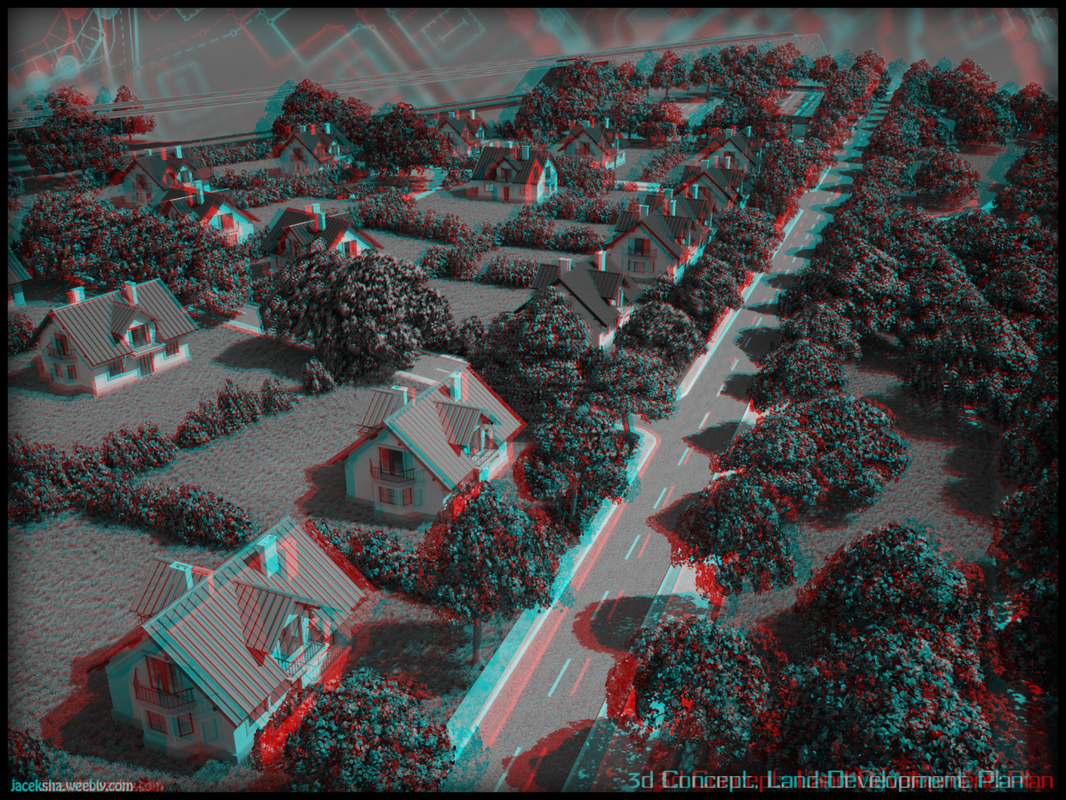
Fly-throughs 960 x 600 14sec 1920x1440 Colorful Stereo Image |
| ||||||
|
|
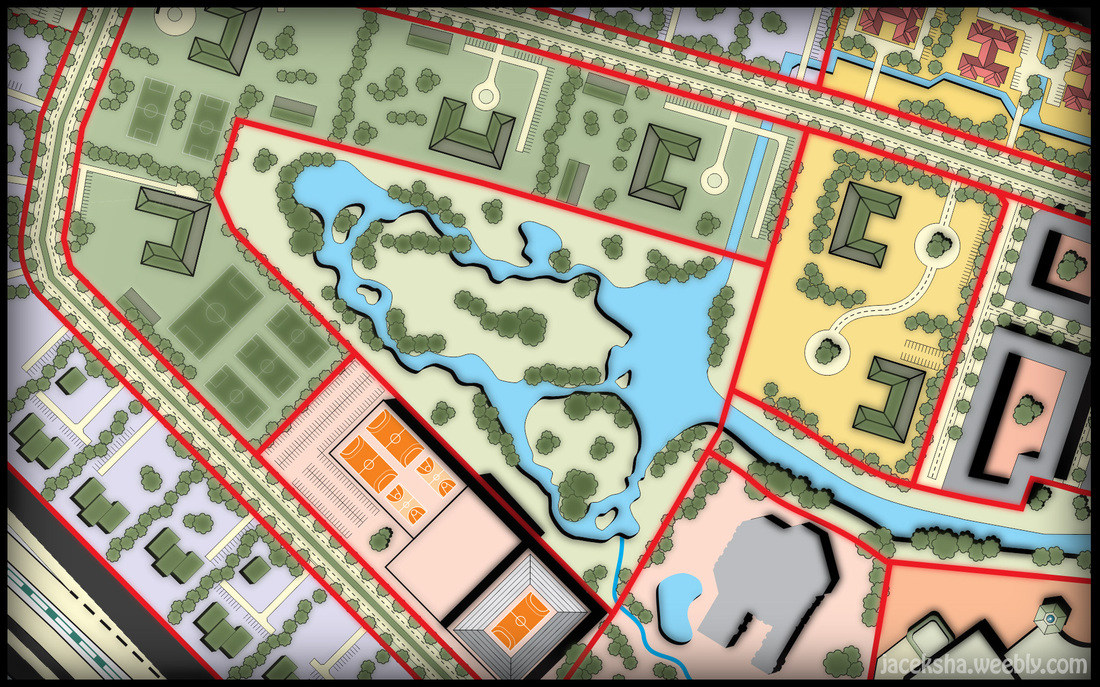
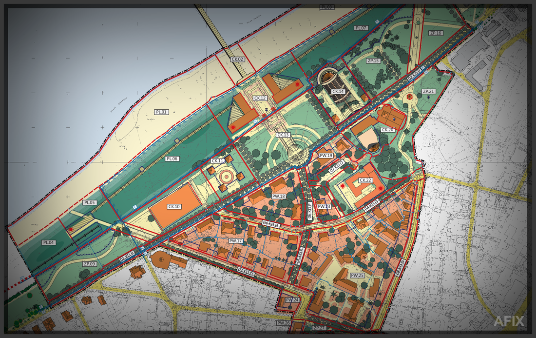
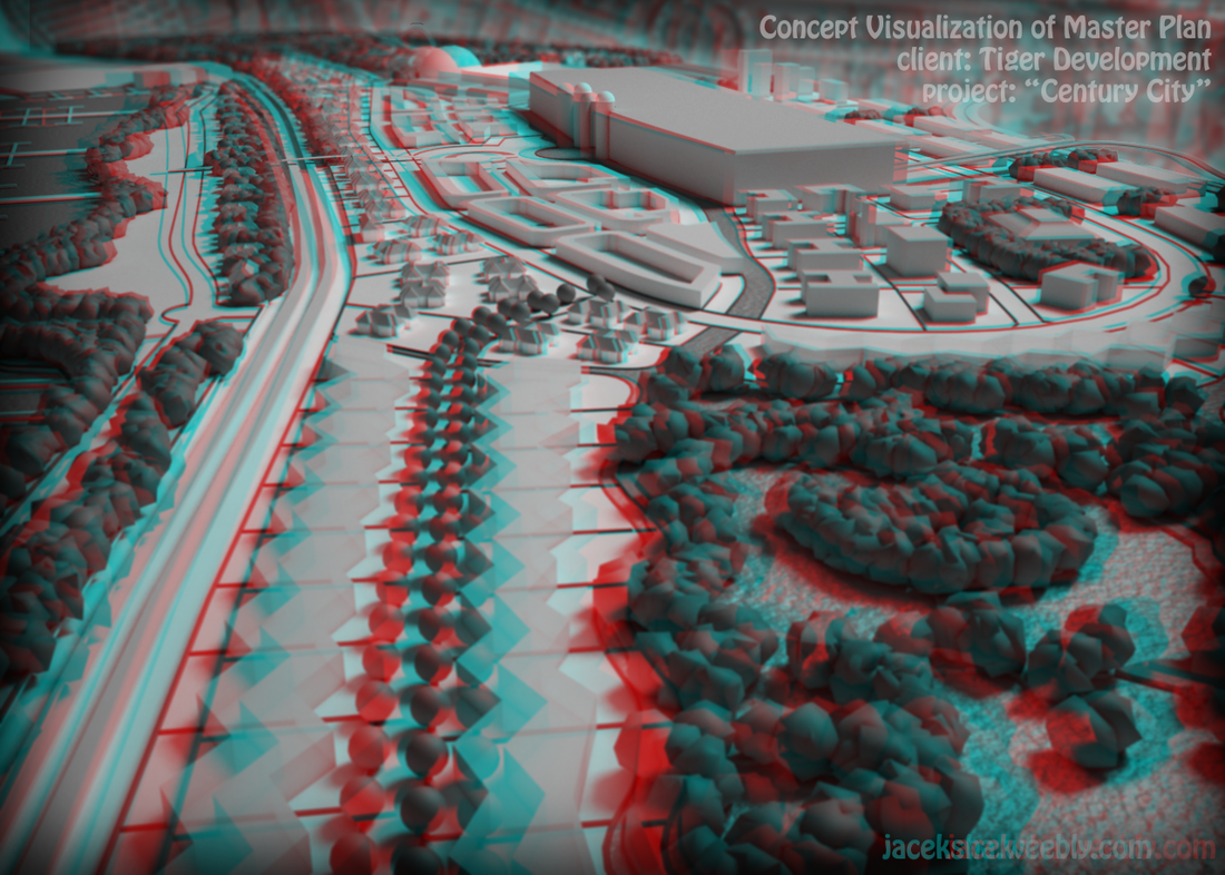
Stereoscopic representation can even more increase the space perception of the studied area. Further below there are examples of Master Plans drafted within all years when working in the studio.
|
|
.... 30 minutes vizualization ... ;)
|
|
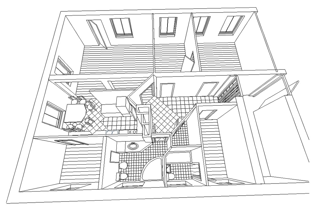
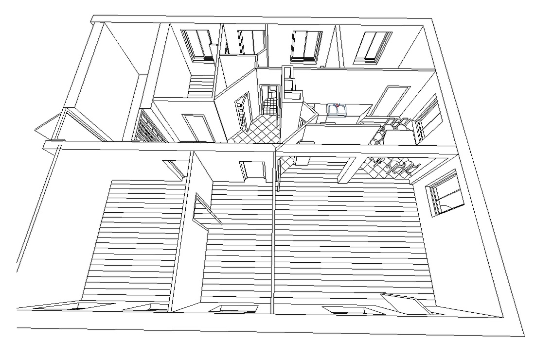
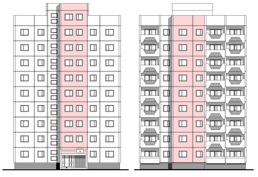
Drafts - Architectural CAD drafts performed on the base of measurments, transformed later into 3d wire model. AutoCAD and ArchiCAD were the base tools I have been using. ArchiCAD had these days a hudge advantage of giving a drafter possibility of introducing properties of the walls while drawing. This way the project could be drawn paralely in 2D and 3D.
Kliknij tutaj, aby edytować.
|
|
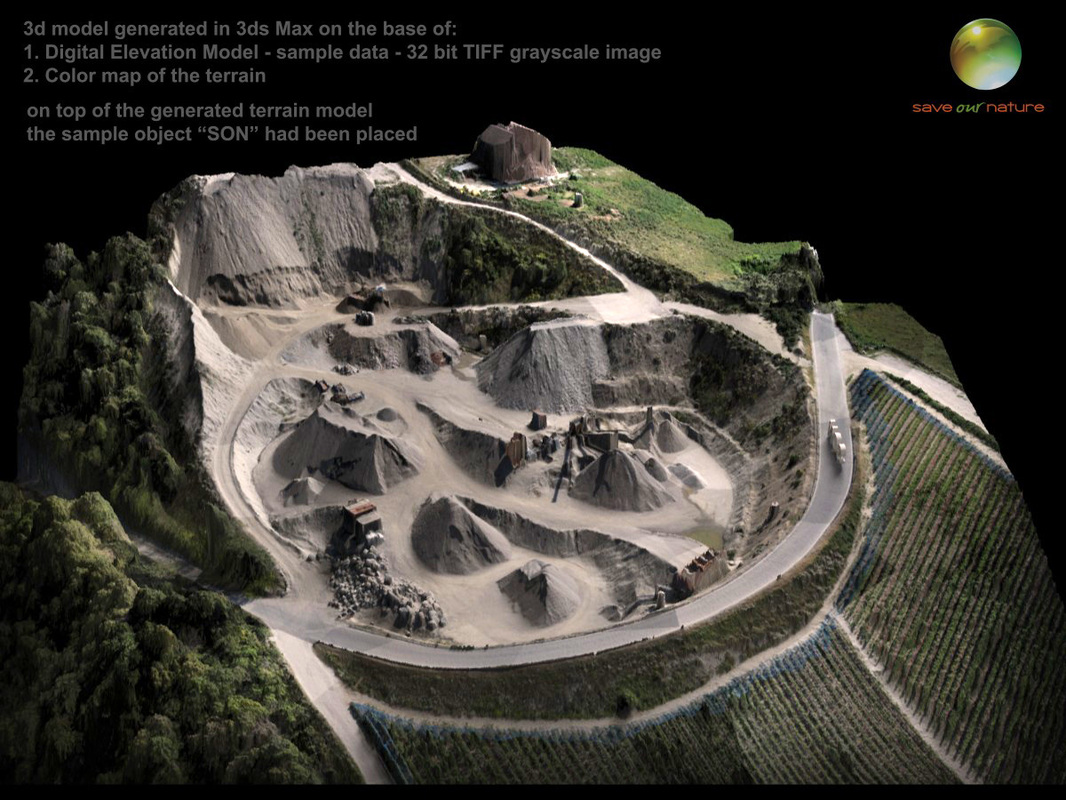
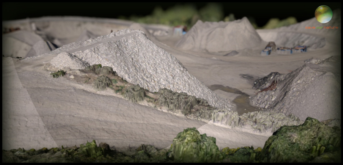
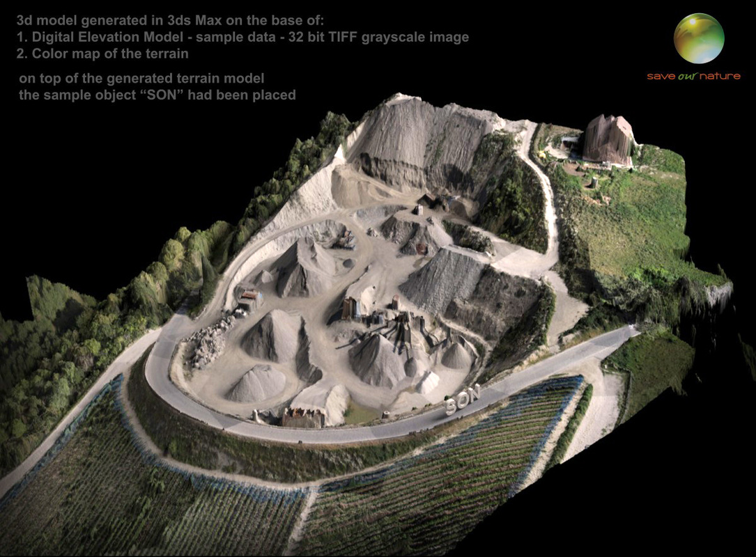
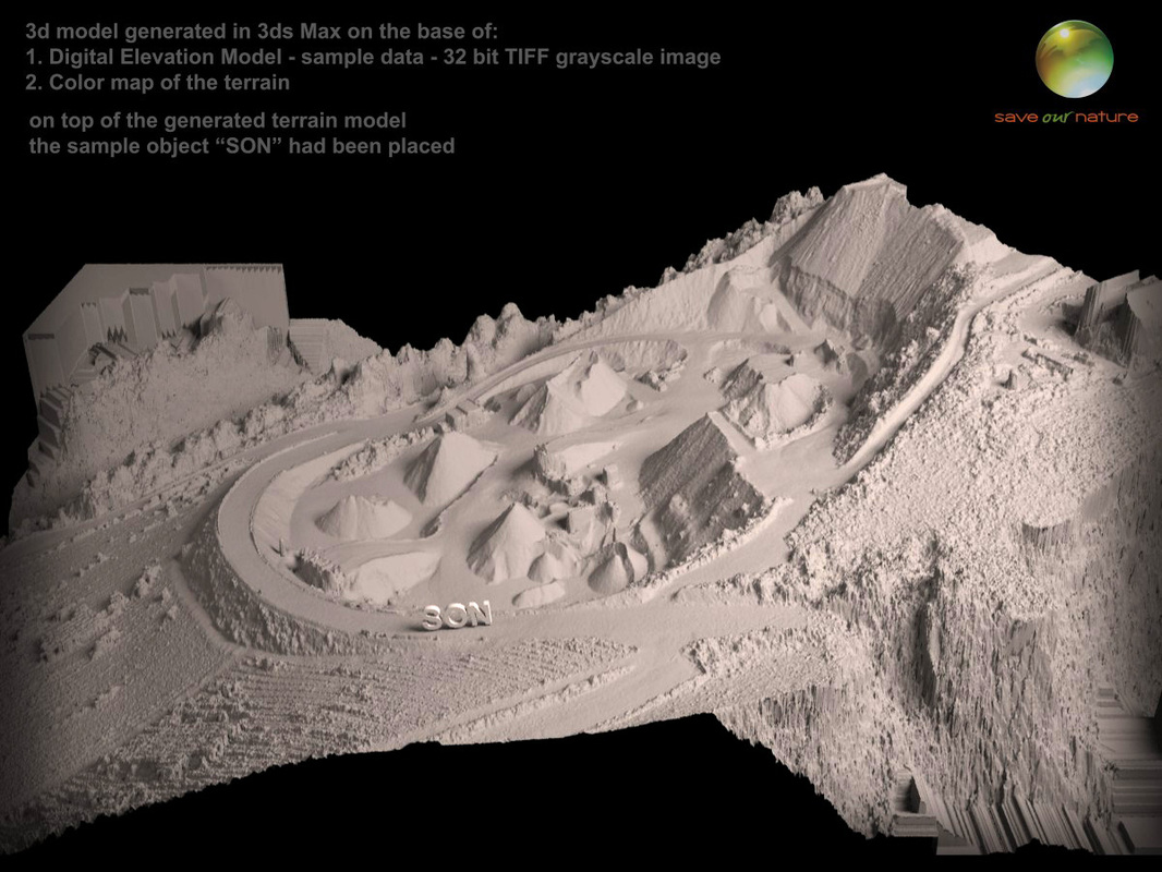
Photogrammetry - Technique of capturing elevation data of terrain by flying UMV I've been testing this technology and was amazed how accurae it can be. There are two data types generated from captured photos. 32 Bit TIFF and a PointCloud readable by CADs softwares. Below the terrein I generated from 32 bit TIFF elevation maps delivered by Dronemapper.com company. The more handy data for working in detailed 3d visualizations is the Point Cloud which represents in a straight way a geometry without using heavy 32 bits displacement maps. I have found great tool for merging Point Clouds into 3ds Max - Clouds2Max. Then, having such detailed 3d reference, you can work on converting clouds into polygonal mesh for texturing and so on. More enhanced converters costs 3-4 thousands Euro but this one is quite cheap - 500 Euro.
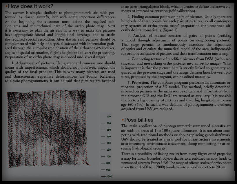
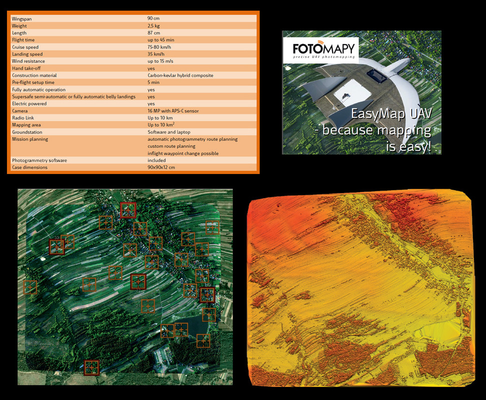
Below, a short description of one of the most competitive systems, which costs around 15 000 Euro including UAV flying drone, software for converting captured photos and the laptop you take out for programming and controlling missions.
|
|
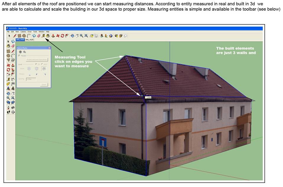
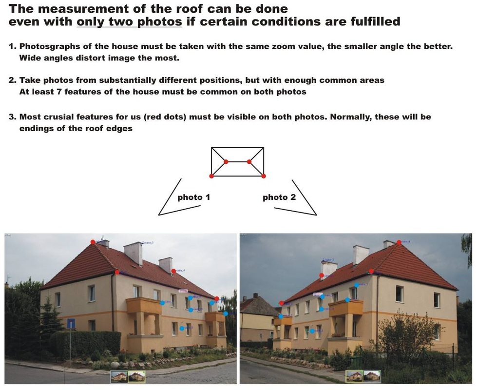
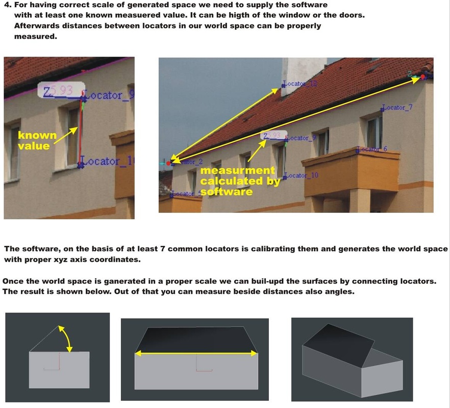
Rough measurements from photos
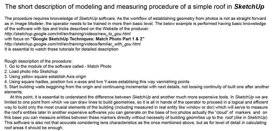
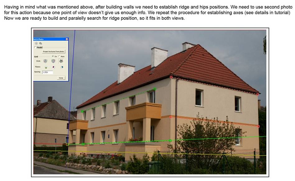
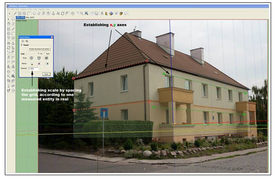
SketchUp gives the possibility of generating roughly shapes of buildings just from few photos. You need to take only one measurment for a real reference and then scale accordingly the object which is resulting from described below procedure.
|
|
|
|
The Image Modeler is more advanced and accurate but costs much more. Here is the procedure.
|
|
